Help topics
- Purpose of the site
- Compass features
- Compass menu
- Compass or GPS - advantages and disadvantages
- Compass Test
- Draw a single or multi-legged route
- Extending the compass direction of travel arrow
- False readings when using a compass
- Fine Tuning the OpenStreetMap Compass
- Getting started with OpenStreetMap Compass
- GPS or Compass - pros and cons for navigation
- Grid references test
- How to use a compass
- Import OpenStreetMap routes
- Key
- Latitude and longitude positions: degrees, minutes and seconds
- Magnetic declination or variation
- Magnetic declination or variation adjustment
- Magnetic declination or variation calculation
- Map projections
- Map reading
- Map reading skills test
- Menu
- Moving the OpenStreetMap Compass
- My OpenStreetMap Compass Map Routes
- Negative magnetic declination or variation
- New Features
- North: different types
- North on OpenStreetMap
- Ordnance Survey maps integration
- OpenStreetMap Key
- Panning and Zooming with OpenStreetMap
- Positive magnetic declination or variation
- Print Map Function
- Projection of OpenStreetMap
- Route drawing
- Route Information Display
- Safety
- Save and Store OpenStreetMap Compass Map Routes
- Single leg or multi-legged routes?
- Test your compass reading skills
- Tips
- Types of bearings
- Updates
- User Guide
- Watch as Compass
- What is a compass?
- What type of compass is used on the site?
- Zooming with OpenStreetMap
OpenStreetMap Compass Route Drawing

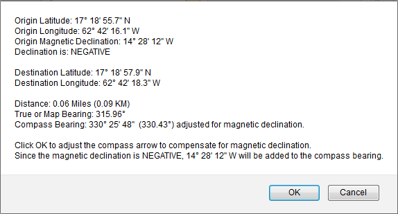
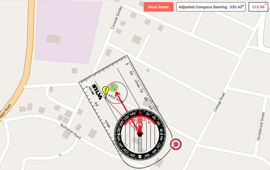
Clicking on the 'Draw Route' button will plot and draw a route to a marker at your selected point of destination and display:  Clicking 'OK' on the display will adjust the red compass direction of travel arrow to compensate for magnetic declination. The compass bearing display adjusted for magnetic declination (14.47º in the above example) will appear in the lower right corner.
The map or true bearing display appears in the upper right corner (315.96º in this example). Clicking 'Cancel' will leave the red direction of travel arrow unadjusted, and no compass bearing display will appear in the lower right corner.
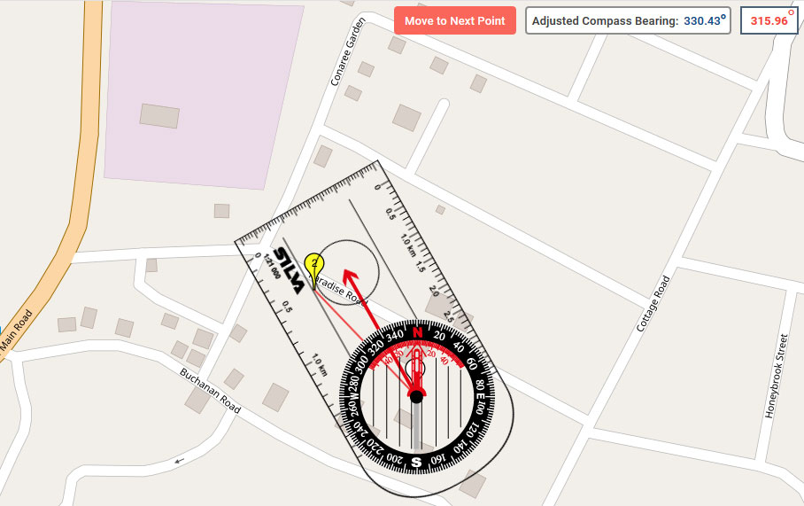
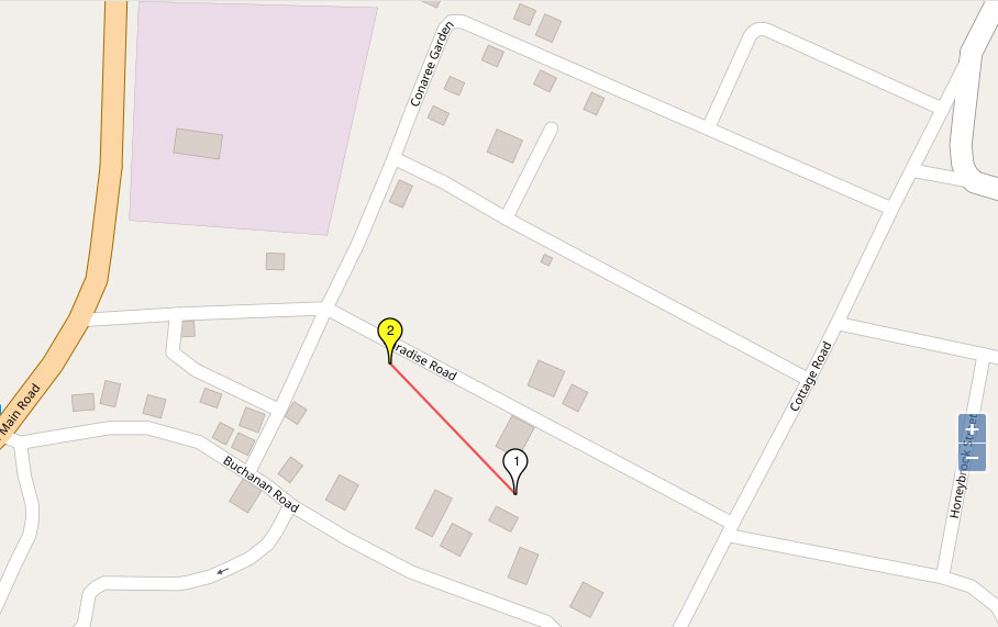
For Multi-Legged routes, click the 'Move to Next Point' button to move the compass to the next point: Once you have finished, you can hide the compass, save and print your route:
- Origin latitude, north or south, in degrees, minutes and seconds.
- Origin longitude, east or west, in degrees, minutes and seconds.
- Origin magnetic declination, east or west, in degrees, minutes and seconds.
- Negative or positive declination.
- Destination latitude, north or south, in degrees, minutes and seconds.
- Destination longitude, east or west, in degrees, minutes and seconds.
- Distance of the route leg in miles and kilometres.
- Map or true bearing in degrees.
- Compass bearing, in degrees, minutes and seconds and decimal, adjusted for magnetic declination.
 Clicking 'OK' on the display will adjust the red compass direction of travel arrow to compensate for magnetic declination. The compass bearing display adjusted for magnetic declination (14.47º in the above example) will appear in the lower right corner.
 The map or true bearing display appears in the upper right corner (315.96º in this example).
 Clicking 'Cancel' will leave the red direction of travel arrow unadjusted, and no compass bearing display will appear in the lower right corner.
 For Multi-Legged routes, click the 'Move to Next Point' button to move the compass to the next point:
 Once you have finished, you can hide the compass, save and print your route:
Copyright © 2019 - 2026 All Rights Reserved
Barcelona Field Studies Centre S.L.